
Products · Monitoring & alerts
Flood Watch — from risk check to evacuation progress
Summary
Staff check risk and response status by zone on the monitoring screen, and can deliver alerts to evacuation support staff and the people they support following procedures set by the institution. Evacuation progress is then gathered back onto the monitoring screen.
Flood warning · Nangok-dong
Hourly rainfall 95.8 mm · alert sent after staff approval
Companion partner accepted
3 vulnerable households assigned in Miseong-dong
Samseong-dong 95% evacuated
Completion reports gather on the monitoring screen
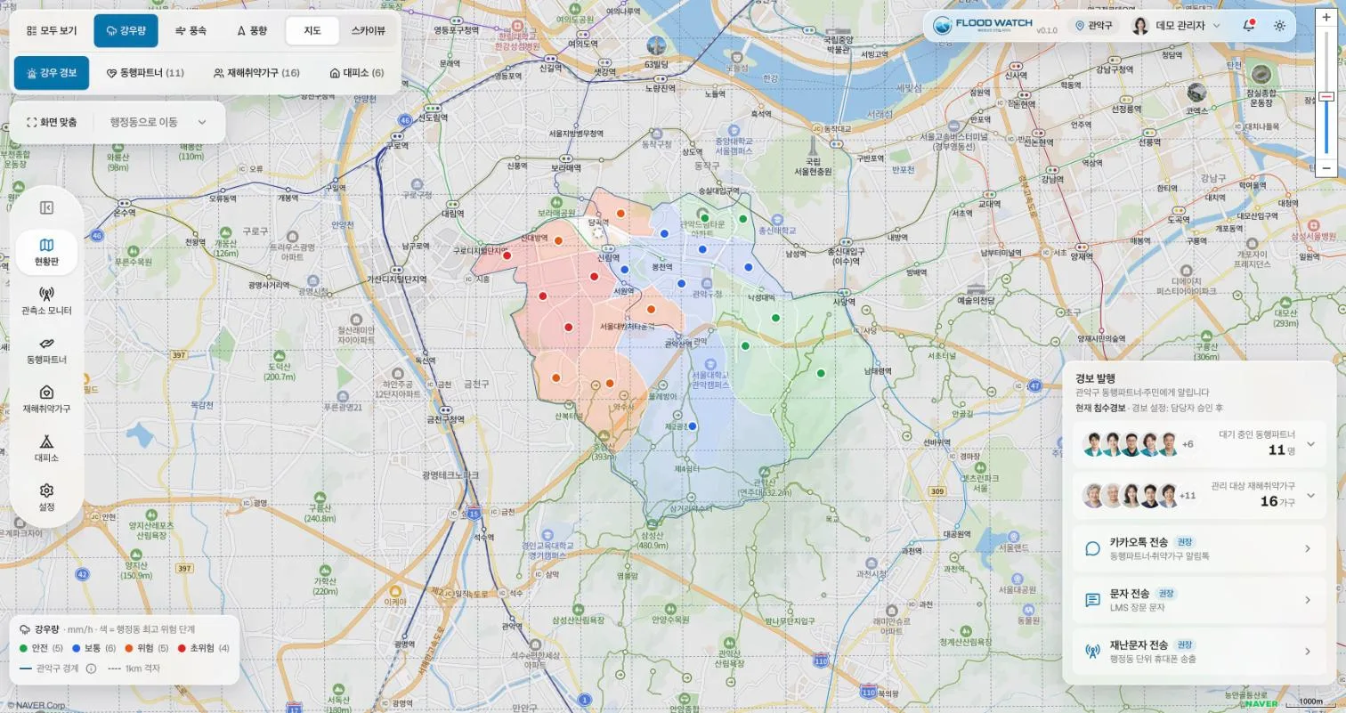
Flood Watch demo screen · sample data
Flood Watch, the real screens
- Risk level by neighborhood, colored on the map
- Gauge locations and values on a 1 km grid
- Send alerts straight from the alert panel
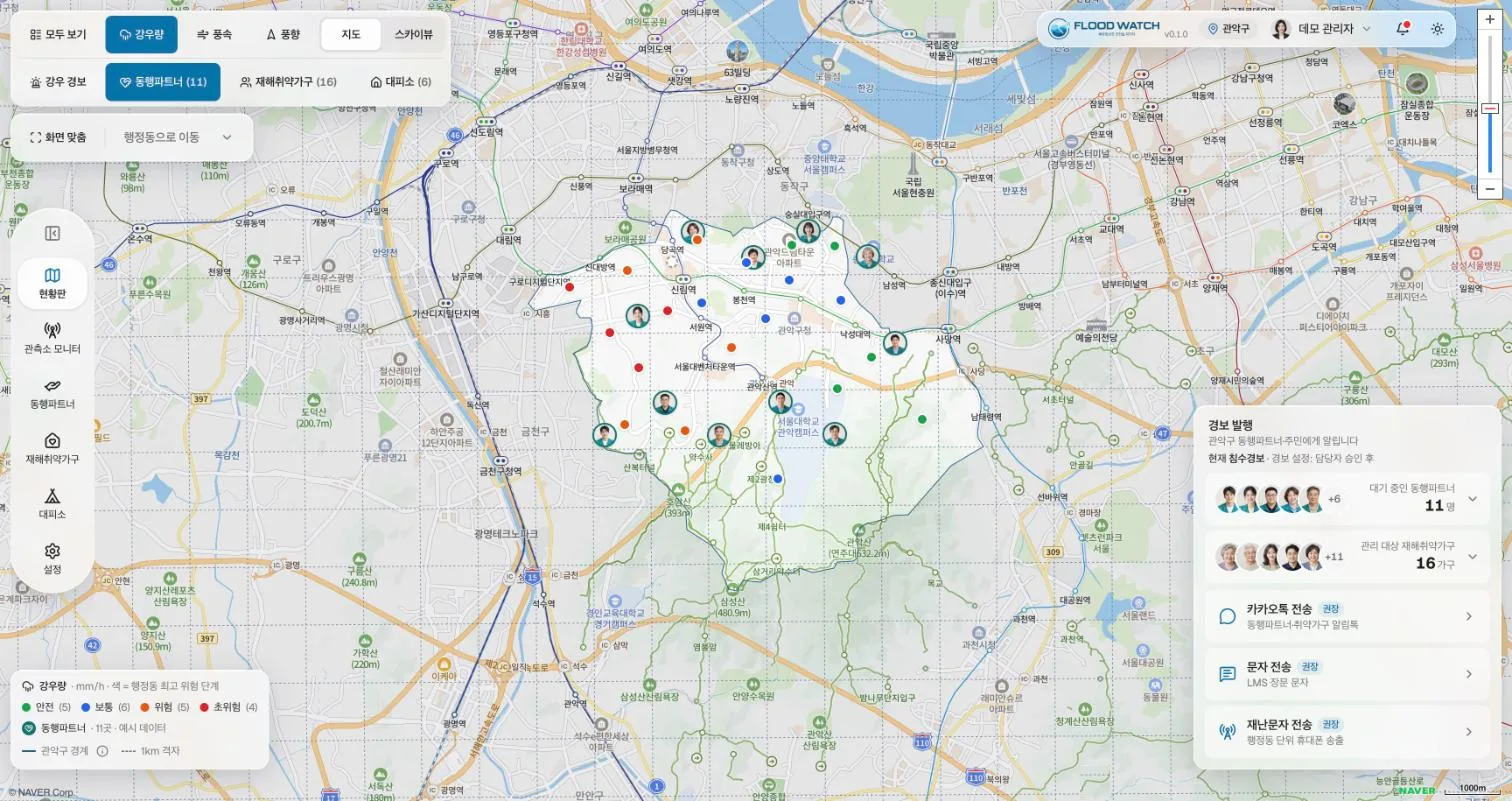
- Where standby companion partners are
- Staff closest to risk zones
- Linked to assigned households
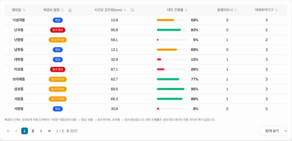
- Advisory and warning level by neighborhood
- Hourly rainfall
- Evacuation progress, live
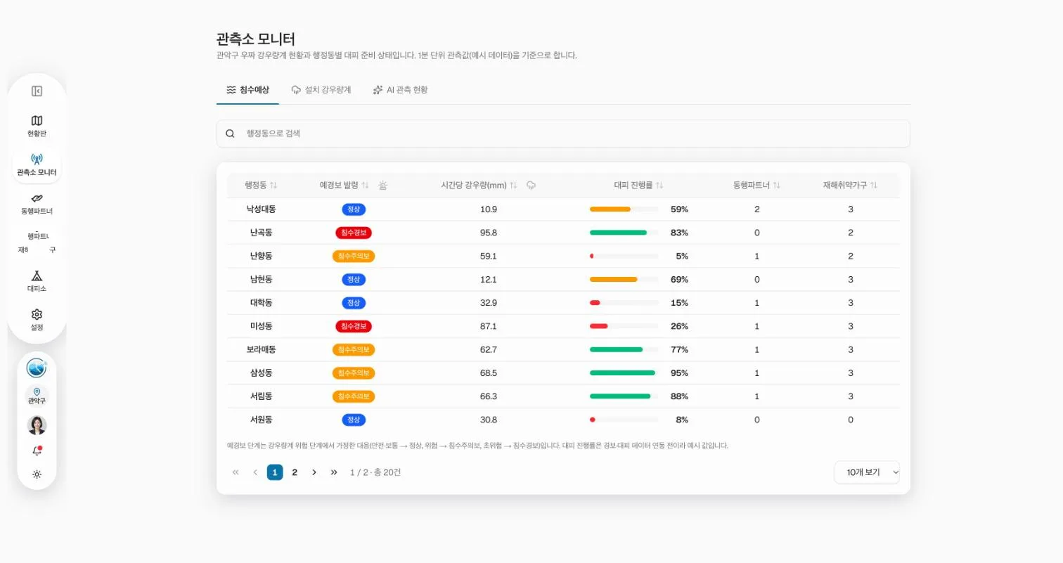
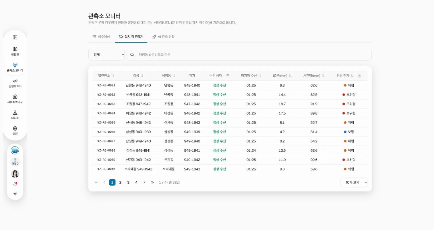
- Link status and last reading per device
- 10-minute and hourly rainfall
- Risk level per device
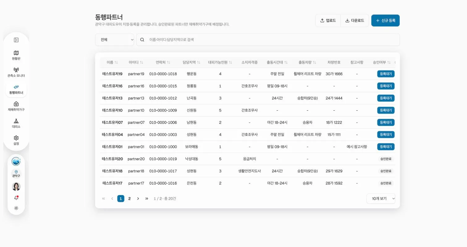
- Area, availability and vehicle
- Assigned to households after approval
- Bulk upload from spreadsheets
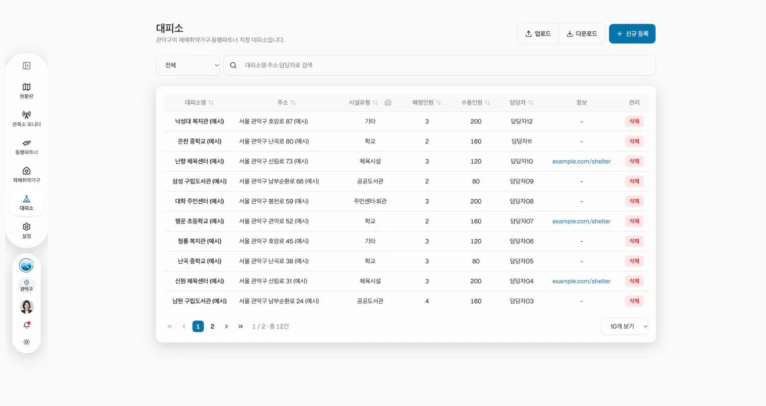
- Facility type and capacity
- Assigned people and contact
- Linked to households and partners
Key features
Status board
Shows rainfall and risk level by observation point in color. See the table below for the level breakdown.
Station monitor
Shows the status of WOOZZA-installed rain gauges and linked sensors on one screen.
Alert settings
Configure and batch-send messages by recipient or evacuation support staff (companion partner). Linking regional emergency text alerts is a matter for future discussion.
Companion partner management
Register and manage evacuation support staff, with bulk upload from a spreadsheet.
Vulnerable household management
Register households that need care and link them to assigned evacuation support staff.
Evacuation progress
Tallies progress from advisory/warning issuance through to completion of evacuation for assigned households.
Risk level display
| Level | Color | Trigger condition | Key action |
|---|---|---|---|
| Level 1 | Green | Observed rainfall within normal range | Monitoring |
| Level 2 | Blue | Approaching the institution’s first threshold | Staff review, prepare response |
| Level 3 | Yellow | First threshold reached | Staff alerted, evacuation support staff on standby |
| Level 4 | Red | Second threshold reached or flood risk predicted | Alert and dispatch to affected people per institution procedure |
Level names, thresholds and send conditions are configured to match each institution’s own advisory/warning criteria.
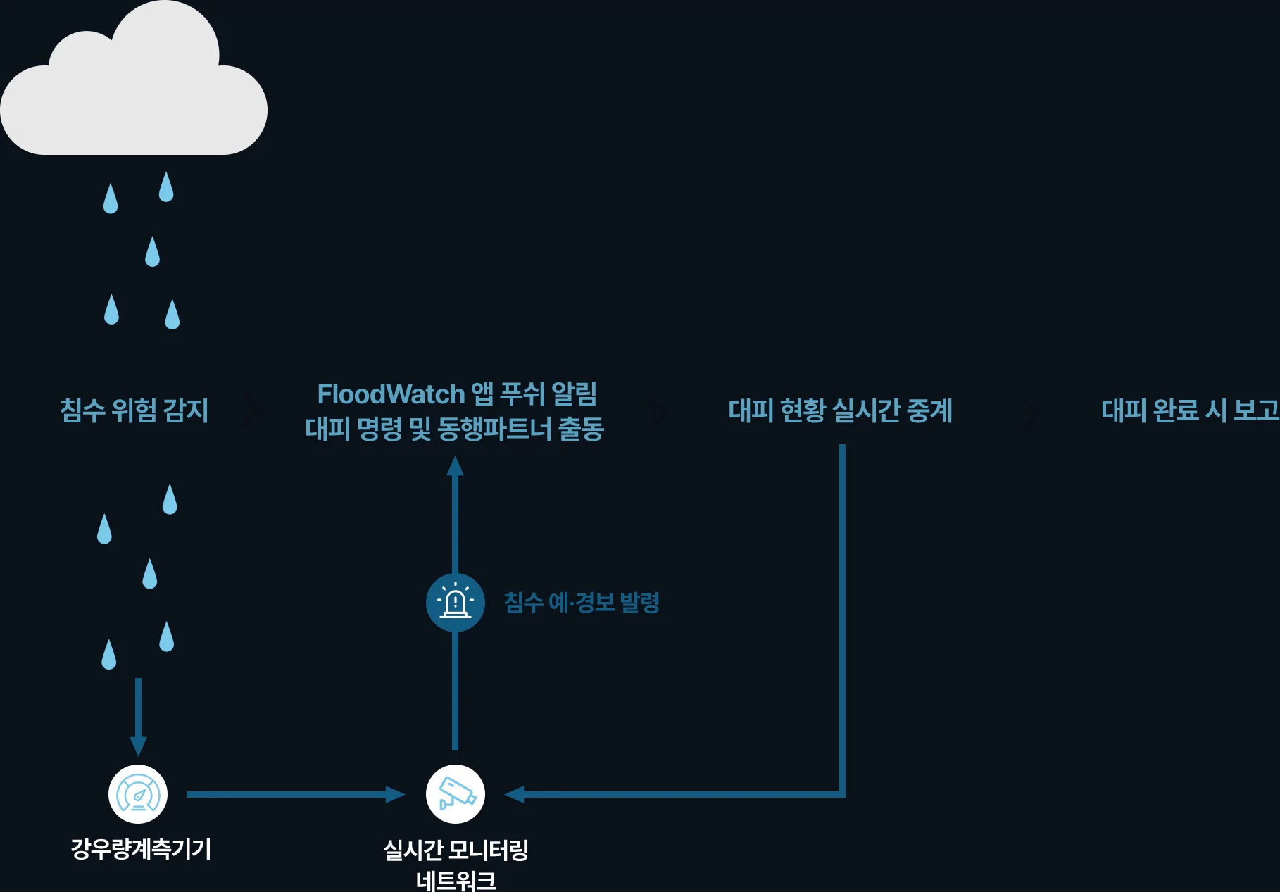
From detection to evacuation-complete report
When rainfall is detected, app alerts reach staff, evacuation support staff and residents. While evacuation is under way, its status is relayed to the monitoring screen, and completion reports are gathered by neighborhood.
The whole process is recorded for after-action review and the next response plan.
Who uses it
- Care officer
Sees risk and evacuation progress by zone in real time and assigns staff.
- Evacuation support staff (companion partners)
Receives a dispatch request and checks the target household’s location and contact details.
- People who need evacuation support
Receive risk level and evacuation guidance on their phone.
- Facility/building manager
Receives risk levels around managed assets and carries out inspection and control measures.
Site requirements
- A legal basis and consent process for handling the personal information of people who need support and evacuation support staff
- Alert-level settings matched to each institution’s own alert criteria and issuance authority
- A connected SMS channel (an institution’s own contract or an agreed service)
Read the Rain. Protect What Matters.